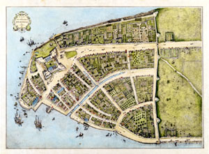
 Redraft of the Castello Plan New Amsterdam in 1660 | The New-York Historical Society
|
 Redraft of the Castello Plan New Amsterdam in 1660 | The New-York Historical Society
|
The New-York Historical Society library holds over 10,000 maps, both printed and manuscript, dating from the seventeenth century through to the present. Geographic scope varies according to time period, ranging from New York City and State to the entire eastern seaboard and all fifty states. Dutch, British, Spanish, French and American maps document the colonization of North America, with later maps reflecting westward exploration and expansion. Among the manuscript map holdings are those of Robert Erskine and Simeon DeWitt, General George Washington's cartographers, and numerous surveys of eighteenth and nineteenth century property maps in New York City and the surrounding region. Twentieth century holdings include maps depicting New York City's overcrowded housing, as well as many regional road, transportation and tourist maps for the entire country.
Please note: Many of the manuscript maps may also be identified through BobCat (www.bobcat.nyu.edu).
Keyword Search | Advanced Search
Browse by Geographic Location, Title, Creator, Call Number or Inventory Number
Copyright and Photographic Reproductions
Please send any comments or questions to DLTS Tech - NYU